India’s north-easternmost state of Arunachal Pradesh has a border with Tibet and is one of the largest territories claimed by the People’s Republic of China (PRC). The watchword here is the “McMahon Line” as Beijing disagrees with New Delhi’s position on acknowledging it as the boundary between China and India.
China rejects the McMahon Line, which it calls “illegal” and “unacceptable,” for the following reasons: first, the Sino-Indian boundary has never been properly demarcated; no treaty or agreement has been made between the Chinese Central Government and the government of India. Second, Beijing rejects the McMahon Line under the pretext of “imperialist legacy” and disregards the 1914 Simla Convention between Britain, China, and Tibet on the grounds that Tibet was not a sovereign state and therefore, had no power to conclude treaties.
Therefore, India and China are stuck in the quagmire of an unresolved boundary dispute due to the absence of an internationally accepted boundary between the two countries, lack of an agreement over the de facto ‘Line of Actual Control,’ and the border not being demarcated on ground or delineated on maps. The outcome being, India–China boundary dispute is divided into three sectors: the western sector, the middle sector, and the eastern sector, of which Arunachal Pradesh is a part.
Arunachal Pradesh Stand in the India-China Boundary Dispute
Over the years, China’s claim to Arunachal Pradesh has expanded from its original scope to include the entire state. Initially, China only laid claim to the Tawang region, but since the 1980s, Beijing has claimed all of Arunachal Pradesh as part of its ‘South Tibet’ territory. In the year 2006 Chinese Ambassador to India, Sun Yuxi stated, “In our [China’s] position, the whole state of Arunachal Pradesh is Chinese territory. And Tawang is only one of the places in it. We are claiming all of that. That is our position”.
What is interesting to note though is that in 1960, Beijing accepted the McMahon Line, which China adamantly condemns in the case of Arunachal Pradesh, in order to settle the border dispute with Myanmar. Moreover, China settled the boundary with Nepal in 1960 by splitting Mount Everest according to the Watershed Principle. However, it disagrees with the McMahon Line that followed the Watershed Principle in the case of India. This further demonstrates China’s biased treatment of the McMahon Line.
Chinese transgressions along the LAC and episodes of stand-offs are a common behavioural pattern demonstrated by China in asserting its sovereignty claims over Arunachal Pradesh. For instance, the Sumdorong Chu standoff in 1986 was the first military confrontation along the disputed McMahon Line after the 1962 War. However, given its claims are neither legally grounded nor historically proven, Beijing has also found new ways to legitimise and reinforce its sovereignty claims over the Indian state, which in Chinese perception is “Zangnan”- the southern part of China’s Tibet and hence, Beijing calls it “South Tibet”.
The official Chinese maps have resulted in the renaming of some locations in Arunachal Pradesh. The names of 15 locations in the Indian state of Arunachal Pradesh were “standardised” in December 2021 by the Chinese Ministry of Aviation, including eight residential settlements, four mountains, two rivers, and one mountain pass. This was the second such Chinese “renaming” in relation to Arunachal Pradesh as a batch of six localities were standardised in April 2017. China uses this strategy to legitimise and strengthen its territorial claims over what it considers to be “South Tibet”, which is legally administered by India.
“Arunachal Pradesh has been and always will be a vital part of India. Assigning invented names to places in Arunachal Pradesh does not alter this fact”, India said in response. Notable about this new “standardisation” is that it followed the implementation of a “new border law” on January 1, 2022. According to Article 2 of the law, it is applicable to the “delimitation and determination of the land boundaries of the People’s Republic of China, the defence, management, and construction of land borders.” Therefore, the issuance of new names on the map is in line with the new legal framework.
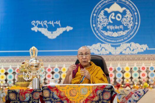
Beijing’s other practice of voicing its claims has been by lodging routine protests on the visits of Indian leaders and the Dalai Lama to Arunachal Pradesh. Beijing opposes the visits mainly on three grounds: first, China’s position on the eastern sector of the China-India boundary is consistent and clear. Second, the Chinese government has never recognised “Arunachal Pradesh”. And third, India should refrain from taking action that complicates the border question but take action to uphold the peace and tranquillity of the border area.
As in recent times, Beijing’s objection was noted against Vice President M. Venkaiah Naidu’s visit to Arunachal Pradesh in October 2021. China’s opposition stands invalid given Arunachal Pradesh is a state of India, as the Ministry of External Affairs rightly posited: “Objecting to the visit of Indian leaders to a state of India does not stand to reason and understanding of the Indian people.“
In addition, Beijing has also adopted the practice of building ‘Xiaokang’ village models along the Upper Subansiri district of Arunachal Pradesh. The 2021 U.S. Department of Defense Report notes that China has constructed a 100-home civilian village “inside disputed territory between the Tibet Autonomous Region and India’s Arunachal Pradesh state in the eastern sector of the LAC,” (located on the banks of the River Tsari Chu, along the disputed border in Upper Subansiri district in Arunachal Pradesh). The 2017 call by Chinese President Xi Jinping to herdsmen in a Tibetan settlement on the border with Arunachal Pradesh to “set down roots in the border area” to safeguard “Chinese territory” is consistent with China’s current “settlement” plan.
Beijing’s assertive behaviour in staking its claim to Arunachal Pradesh is reflected in these unilateral acts, but China fails to realise that India actually manages the territory legally while it merely claims it. As the Chinese way of saying it- “Arunachal Pradesh is an integral and inalienable part of India”.


