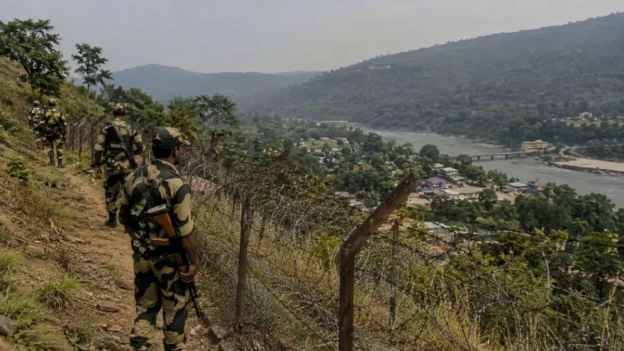

The reopening of Nathu-La (Tib: Natu-La) as a trade route between Sikkim in India and Dromo (Ch: Yadong) in Chinese-occupied Tibet has strengthened border trade and exchange in the Eastern Himalaya, although the region’s geostrategic uncertainty remains unresolved.
Nathu-La (Tib: Natu-La) is an international border-trade route linking two major Himalayan trade centres: Sherathang in East Sikkim, India, and Nadong (Tib: སྣ་གདོང།; Ch: Yatung) in Dromo, Tibet. ‘Yatung’ or ‘Yadong’ is an English and Chinese distortion of the Tibetan name. Nadong means ‘front of a nose’, a reference to its location before Natu-La.
In Tibetan and Sikkimese historical accounts, the pass is locally known as Natu-La (སྣ་ཐོད་ལ་འམ་སྣ་ཐོས་ལ་), meaning ‘nose pass’. In Tibetan, ‘na’ means nose, ‘tu’ means above or over, and ‘la’ means mountain pass.
In topography and geomorphology, a protruding, tapered landform resembling a nose is called a nose or spur-end. Reflecting these features, Tibetans and Sikkimese named the pass Natu-La.
Within the next decade, Dromo (Ch: Yadong) is likely to emerge as both a security and economic hub. Under China’s Western Development Strategy, Beijing plans to extend the railway from Lhasa to Yadong. If the line reaches lower Dromo, which borders Bhutan and Sikkim, it could significantly alter the region’s economic prospects and strategic balance, bringing either greater prosperity or heightened vulnerability.
Today, Dromo (Ch: Yadong) is administered as a county under Shigatse City in the so-called Tibet Autonomous Region. Chinese strategists and economists regard it as a strategic and developmental gateway to South Asia.
Chumbi Valley as a strategic pivot
Some Tibetan sources suggest that Chumbi, or Chumbi Nadong, was an earlier name for Dromo. It was a small village about six miles from Nathu-La (Tib: Natu-La). In 1894, the British Indian government established a trade mission there. Twelve years later, in 1906, Britain moved its trade office to Shasima. Today, it serves as Dromo’s administrative headquarters. After 1906, Nadong became widely known as Yatung, a name now commonly used for Dromo, although it has no clear topographical basis.
The British used Chumbi Valley as a route for their 1903 invasion of Tibet. Chinese nationalists later viewed that invasion as a direct threat to China, describing Tibet as China’s open back door. Britain’s interest in Tibet was to use it as a bulwark against the expanding Tsarist Russian Empire.
After Britain withdrew from India in 1947, South Asia’s political map changed dramatically. Partition created India and Pakistan, including West and East Pakistan, and weakened India’s geographic position in the region. Three years later, China invaded Tibet, bringing its frontier directly to India and Bhutan.
The creation of East Pakistan beside India’s West Bengal further heightened India’s strategic vulnerability. This geopolitical shift exposed what strategists call the ‘Chicken Neck’: the narrow corridor linking mainland India to its seven north-eastern states.
China’s 2017 road construction in Doklam brought what India views as ‘China’s Dagger’ closer to the ‘Chicken Neck’, a corridor it regards as a strategic Achilles’ heel.
The valley served as a trade route in the early twentieth century and became a military corridor after China’s occupation of Tibet in 1950, especially following the Sino-Indian War of 1962.
Bhutan as a buffer State
Bhutan plays a vital balancing role in the region because of its strategic location. During the 2017 Doklam stand-off between China and India, its position gave it particular geopolitical significance.
Bhutan remains the only sovereign Himalayan kingdom that preserves its traditional Buddhist values while pursuing modern development and innovation.
Before China’s invasion of Tibet in 1950, Tibet served as a strategic buffer between British India and China. That role has now shifted largely to Nepal and Bhutan. Today, Bhutan lies between China-occupied Tibet and India, yet its geostrategic importance to both powers has received limited global attention. After the 2017 Doklam military stand-off, strategic communities increasingly recognised Bhutan as a crucial bridge between India and China-occupied Tibet.
The strategic importance of Tibet in India-China relations
Tibet stood for more than two millennia as both a trade corridor and a strategic passage between India and China before 1950. Its historic role as a strategic buffer has since shifted largely to Nepal, Bhutan, and other Himalayan regions. As a result, the Himalaya have become a central arena in the new Great Game between the two Asian powers.
In 1964, George Ginsburg and Michael Mathos argued that ‘he who holds Tibet dominates the Himalaya piedmont; he who dominates the Himalaya piedmont threatens the Indian subcontinent and may well have all of South Asia within his reach and with that all of Asia.’
Chinese strategists have long regarded Tibet’s geography as essential to China’s defence, strategic depth, and wider geopolitical ambitions in South Asia.
India shares a 3,488-kilometre border with Chinese-occupied Tibet, extending from Ladakh to Arunachal Pradesh. Of this, Sikkim accounts for a 220-kilometre stretch, defined by the Anglo-Chinese Convention of 1890 without Tibet’s participation or consent. Article I states: ‘The boundary of Sikkim and Tibet shall be the crest of the mountain range separating the water flowing into the Sikkim Teesta and its affluents from the water flowing into the Tibetan Mochu and northwards into the rivers of Tibet. The line commences at Mount Gipmochi on the Bhutan frontier and follows the above-mentioned water parting to the point where it meets Nepal territory.’
China’s occupation of Tibet in 1950 and the Sino-Indian War of 1962 disrupted the long-standing stability and open exchange of the Himalayan borderlands. China’s restrictive border-management and security policies ended traditional trade, depriving many trading and nomadic communities of their former livelihoods.
Today, water and grazing rights, along with cross-border trade and exchange between India and Tibet, depend largely on the course of China-India strategic relations. The Himalayan belt is now widely regarded as the Indian subcontinent’s first line of defence against potential Chinese expansion. Many Himalayan communities also retain deep Tibetan cultural roots and continue to practise Tibetan Buddhism.
The reopening of the Nathu-La trade route reflects a strategic adjustment between India and China. From a strategic perspective, geopolitical barriers and competing ambitions remain the primary obstacles to peaceful coexistence in the region. Resolving the Tibet conflict by establishing Tibet as a peace zone in Asia would be the most effective way to restore harmony, create a bridge between India and China, and end the new Great Game in the Himalayas. It would also provide a lasting foundation for trade and exchange among India, Tibet, and China across the Himalaya and South Asia, while strengthening the prospects for an Asian century.