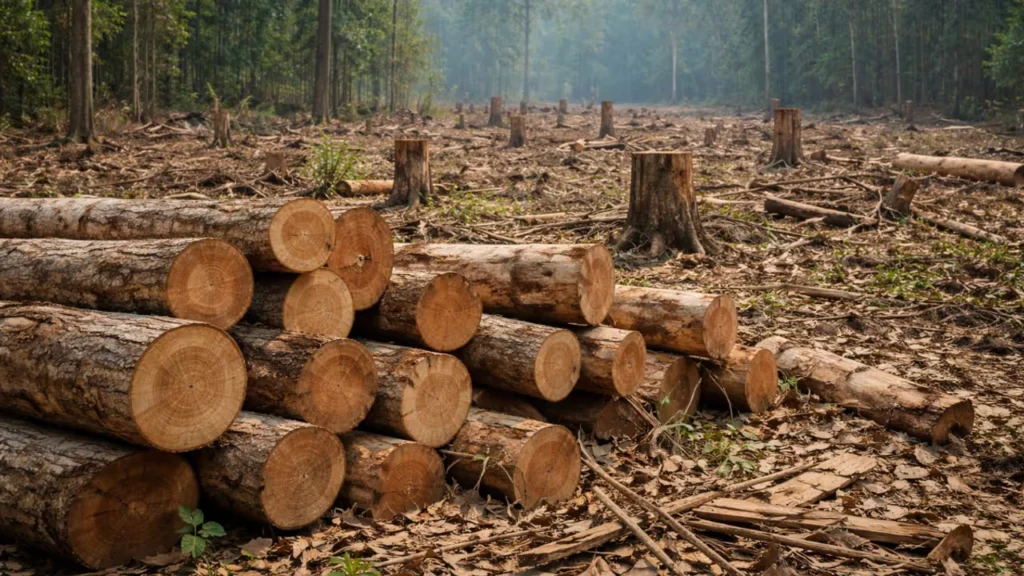
Assam has lost an estimated 3,600 sq km of tree cover since 2001, with the hill districts of Karbi Anglong and Dima Hasao accounting for nearly two-thirds of the decline, according to data from Global Forest Watch (GFW). The continuing depletion of tree cover has raised concerns over carbon emissions, changing land-use patterns, biodiversity loss and increasing human-wildlife conflict.
Karbi Anglong has recorded the highest cumulative tree-cover loss in the State, estimated at around 1,300 sq km, followed by Dima Hasao at approximately 900 sq km. Together, the two districts account for nearly 62 per cent of Assam’s total loss over the past 25 years.
The figures underline the growing environmental pressures facing Assam’s hill districts, where shifting cultivation, settlement expansion, infrastructure development, mining and other land-use changes have contributed to the transformation of forested landscapes.
The scale of the decline is also evident in earlier assessments. Between 2001 and 2023, Assam lost approximately 324,000 hectares, or 3,240 sq km, of tree cover, representing a 12 per cent reduction relative to its 2000 tree-cover extent. The loss was associated with an estimated 152 million tonnes of carbon dioxide emissions.
The trend continued in 2025, when Assam lost around 18,000 hectares of natural forest, equivalent to an estimated 8.3 million tonnes of carbon dioxide emissions. Karbi Anglong accounted for approximately 8,800 hectares and Dima Hasao for another 5,000 hectares, together representing more than three-fourths of the State’s natural-forest loss that year.
According to GFW, Assam had approximately 2.6 million hectares of natural forest in 2020, making the continued decline particularly significant for a State whose ecological stability depends heavily on its forests.
The pressure is not confined to the two hill districts. Sonitpur, Tinsukia and Kokrajhar have also experienced substantial tree-cover losses, estimated at between 140 and 180 sq km in earlier assessments covering periods up to 2023.
Although districts in Lower Assam and the Brahmaputra Valley have recorded comparatively smaller absolute losses, localised forest degradation associated with infrastructure development, settlement expansion and changing land use remains a concern.
The consequences extend beyond the disappearance of trees. Forest degradation can affect local ecosystems, wildlife habitats, water retention and soil stability, while potentially increasing the vulnerability of communities living near forested areas.
A senior official of the National Health Mission (NHM), Assam, who requested anonymity, also linked changing land-use patterns in Karbi Anglong and Dima Hasao to the spread of dengue.
“Due to massive deforestation, Karbi Anglong and Dima Hasao have experienced alternating surges in dengue cases, with each district ranking as the hardest-hit in the state during different periods. More than 90 per cent of cases were reported from Karbi Anglong,” the official said.
“The Aedes aegypti mosquito primarily spreads dengue. It is an urban mosquito. It never grows in rural or forest areas. Since forest in Karbi Anglong turned into human habitation, the mosquito also grows up here,” the official added.
While changes in land use and human settlement can influence mosquito habitats and disease transmission, the relationship between deforestation and dengue is complex. The mosquito can also breed in rural and peri-urban settlements, particularly where suitable water-storage conditions exist.
The official’s observations nevertheless point to a broader public-health concern associated with changing human environments, particularly in areas undergoing rapid settlement and infrastructure expansion.
Environmental activist Apruba Ballav Goswami said the scale of tree-cover loss has also imposed a substantial carbon cost on Assam.
“The state’s 324,000-hectare tree-cover loss between 2001 and 2023 resulted in 152 million tonnes of CO2 emissions. In 2025 alone, the state lost 18,000 hectares of natural forest, producing 8.3 million tonnes of CO2 emissions. Of this, Karbi Anglong accounted for 8,800 hectares and Dima Hasao for 5,000 hectares, together representing more than three-fourths of the state’s annual natural-forest loss,” he said.
“This means the hill districts are not only losing forest area; they are also releasing a disproportionate share of Assam’s forest-related carbon emissions,” Goswami added.
He explained that GFW’s tree-cover loss assessments are derived from Landsat satellite imagery at a resolution of 30 metres, using datasets developed through research involving the University of Maryland and satellite observations supported by agencies including NASA and the United States Geological Survey.
The satellite-based monitoring system provides a consistent means of tracking changes in tree cover over time. However, tree-cover loss does not necessarily mean permanent deforestation, as it may also include temporary canopy removal associated with shifting cultivation, timber harvesting, fires or natural disturbances.
This distinction is especially relevant to the Northeast, where traditional land-use practices, including shifting cultivation, form part of the region’s agricultural and ecological landscape.
Nevertheless, the cumulative figures indicate substantial pressure on tree-covered landscapes, particularly where vegetation loss is accompanied by permanent conversion of land for settlements, infrastructure and commercial activities.
Environmental activist Dilip Nath questioned whether the ecological costs of development projects were receiving adequate consideration.
“The key question is whether development is unavoidable at the present ecological cost. Assam’s forest loss has a measurable carbon cost—152 million tonnes of CO2 over 2001-23—and that the highest-loss districts are also those facing intense land-use pressure,” Nath said.
He alleged that large-scale tree felling had accompanied infrastructure projects across the State, including highway expansion, power generation and dam construction.
“Thousands of trees have been felled due to expansion of National Highways and construction of power projects and dam projects at different parts of the state. Simultaneously, illegal mining has been allowed in reserve forest areas,” he alleged.
Nath also identified encroachment as a contributing factor and questioned what he described as inconsistencies in enforcement against illegal occupation of forest land.
“Encroachment in forest areas is also a responsible factor. The government which evicted encroachers in some places, does not take any action against encroachers in Sonai Rupai Wildlife Sanctuary in Sonitpur district. As a result of forest cover loss, human-animal conflict has gone up,” he said.
He further criticised the effectiveness of plantation programmes undertaken by government agencies, claiming that these initiatives had failed to adequately compensate for the continuing loss of forest cover.
The concerns raised by environmental activists reflect a wider challenge confronting Assam: balancing infrastructure development and expanding human settlements with the protection of ecologically sensitive landscapes.
Forest degradation around protected areas can weaken natural buffers, fragment wildlife habitats and disrupt traditional movement corridors. Such changes may increase encounters between wildlife and human settlements, particularly where agricultural land and infrastructure extend into previously forested areas.
The pressure is not limited to privately held or community-managed land. Official assessments have also recorded changes within legally recognised forest areas.
According to the India State of Forest Report (ISFR) 2023, Assam recorded a decline of 86.66 sq km in forest cover within recorded forest areas between 2021 and 2023.
The report placed the State’s overall forest cover at 28,313.55 sq km, accounting for 36.10 per cent of its geographical area of 78,438 sq km. This represented a net decline of 11.76 sq km compared with the 2021 assessment.
Forest and tree cover combined stood at 30,415.01 sq km, reflecting a net decrease of 83.92 sq km over the two-year period.
The decline was also reflected in changes to moderately dense forest within recorded forest areas. West Karbi Anglong alone registered a reduction of 9.20 sq km compared with 2021.
These figures provide an important perspective on the changing condition of Assam’s forests. They also highlight differences between official forest-cover assessments and independent satellite-based monitoring.
Official parliamentary and State data indicate that Assam registered a net increase of 748.65 sq km in forest cover between 2013 and 2023. Yet GFW’s monitoring records substantial cumulative tree-cover loss across several districts over a longer period.
The apparent contrast does not necessarily indicate an inconsistency. The two assessments measure different aspects of vegetation cover, use different classification systems and cover different periods.
GFW records the gross removal of tree cover, including trees in natural forests, plantations and certain commercial tree crops. Its cumulative loss figures do not automatically account for subsequent regrowth or gains elsewhere.
The Forest Survey of India (FSI), on the other hand, assesses forest cover using canopy-density and area criteria, irrespective of land ownership or legal classification. Its net-change figures therefore reflect a different measurement of vegetation cover.
Consequently, a State may register a net increase in overall forest cover while individual districts continue to experience substantial canopy loss or degradation of natural forests.
This distinction is particularly important when evaluating whether increases in plantations or tree cover elsewhere can compensate for the ecological functions of older, naturally regenerated forests.
Beyond biodiversity, forest depletion has implications for local climate regulation. Forests contribute to temperature moderation, humidity, soil moisture, groundwater recharge and the capacity of landscapes to absorb rainfall.
Their removal can increase surface temperatures, accelerate soil erosion and reduce water retention, potentially worsening the effects of extreme weather events.
An Assam-focused analysis of meteorological and land-use data between 2004 and 2023 found that the mean annual temperature increased by nearly one degree Celsius, from approximately 23.72 degrees Celsius in 2004 to 24.73 degrees Celsius in 2023.
The analysis also reported increasingly erratic rainfall, a marginal overall decline in annual precipitation and a strong correlation between rising temperatures, irregular rainfall patterns and forest degradation.
However, the relationship between local forest loss and climatic changes remains complex. Broader regional and global climate influences, along with land-use changes, can affect temperature and rainfall trends. Correlation alone does not establish that deforestation caused the observed changes.
The State government has undertaken afforestation programmes covering more than 163 sq km between 2010-11 and 2025-26 as part of its climate-change mitigation efforts.
Compensatory afforestation and plantation initiatives have also been implemented through the Compensatory Afforestation Fund Management and Planning Authority (CAMPA) and related schemes.
The effectiveness of such programmes, however, depends not merely on the number of saplings planted or the area brought under plantation, but also on survival rates, species diversity, ecological suitability and long-term canopy recovery.
Forest Department assessments up to 2024-25 placed Assam’s recorded forest area at approximately 26,836 sq km.
Meanwhile, diversion of forest land for non-forestry purposes remains another significant concern. Approximately 1,879.59 hectares of forest land were diverted for non-forest use between 2020-21 and 2024-25.
The debate over how forest cover is measured and reported has also attracted criticism at the national level.
In February 2025, a group of 60 retired senior bureaucrats representing the Constitutional Conduct Group (CCG), including former Indian Forest Service, Indian Administrative Service and Indian Police Service officers, wrote to the Union Ministry of Environment, Forest and Climate Change.
The group questioned the Forest Survey of India’s methodology, alleging that the inclusion of commercial monoculture plantations, including coconut and rubber, in forest-cover assessments could create a misleading impression of ecological recovery.
It argued that reported increases in green cover could obscure localised deforestation and the deterioration of natural forests, particularly in high-altitude regions and the Northeast.
The retired officials also claimed that more than 300,000 hectares of forest land had been cleared for non-forestry development projects across India over the preceding 15 years, raising concerns about the adequacy of existing forest protection measures.
Their observations have added to a continuing debate over whether increases in measured green cover necessarily reflect improvements in forest health, biodiversity and ecological resilience.
For Assam, the issue is particularly significant because its hill districts contain extensive forested landscapes that support biodiversity, traditional livelihoods and important ecological processes.
The latest figures suggest that the challenge is not simply one of increasing tree cover, but of understanding where forests are disappearing, what is replacing them and whether restoration measures are capable of recovering their ecological functions.
The next India State of Forest Report is expected to provide updated biennial assessments. Until then, ISFR 2023 and GFW’s more recent satellite observations remain important sources for evaluating changes in Assam’s forests, although their findings require interpretation within their respective methodologies.
The continuing loss of tree cover in Karbi Anglong and Dima Hasao raises questions that extend beyond environmental statistics. It brings into focus the long-term consequences of land-use decisions, infrastructure expansion and the effectiveness of forest conservation measures.
For Assam, the larger challenge lies in ensuring that development does not come at the cost of the forests that sustain its ecological balance, biodiversity and local communities. The future of its hill landscapes will depend as much on protecting existing natural forests as on restoring those already lost.