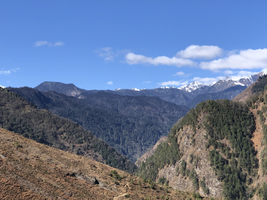
China has spent years trying to put its own names on places in Arunachal Pradesh, which it refers to as Zangnan. Now New Delhi has answered in its own way.
The Indian government has formally identified 27 places and geographical features in Arunachal Pradesh by their standard Indian names on the official Survey of India map. The move is an unmistakable cartographic assertion at a time when Beijing has repeatedly sought to establish its own nomenclature for places in a state that India administers and regards as an integral part of the country.
In that sense, India has entered the name game. But this is not simply a contest over what a village, pass or lake is called. In a disputed and heavily militarised borderland, naming a place on an official map is also a way of asserting that the place belongs within a particular political and territorial imagination.
The latest list includes 21 land areas—Longju, Maja, Bisa, Bara Kundun, Chhota Kundun, Dhan Bari, Pritnagar, Buddhamandir, Jairampur, Teritnagar, Ramnagar, Jaswant Garh, Sagar, Padma, Jyotinagar, Baisakhi, Chhota Ropuk, Bara Ropuk, Shivaji Nagar, Sunpura and Kamlang Nagar. It also includes four passes—Dzo La, Riza La, Pukur La and Thag La—along with Sambho Sarovar lake and the Sher-e-Thapa Memorial.
China has so far not publicly reacted to India’s latest naming exercise. But the move comes after Beijing itself released successive lists of standardised names for places in Arunachal Pradesh—six names in 2017, 15 in 2021 and another 11 in 2023.
The cartographic contest is therefore unlikely to end with this latest list.
But perhaps the more important question is what these names mean when one leaves the map behind.
The border looks different on the ground
This is where places such as Taksing and Maja become important.
The Borderlens team travelled through this remote part of Upper Subansiri a few years ago, reaching Taksing and continuing towards Gelemo and Maja. The journey itself offered a sense of why the region occupies such an important place in India’s frontier geography.
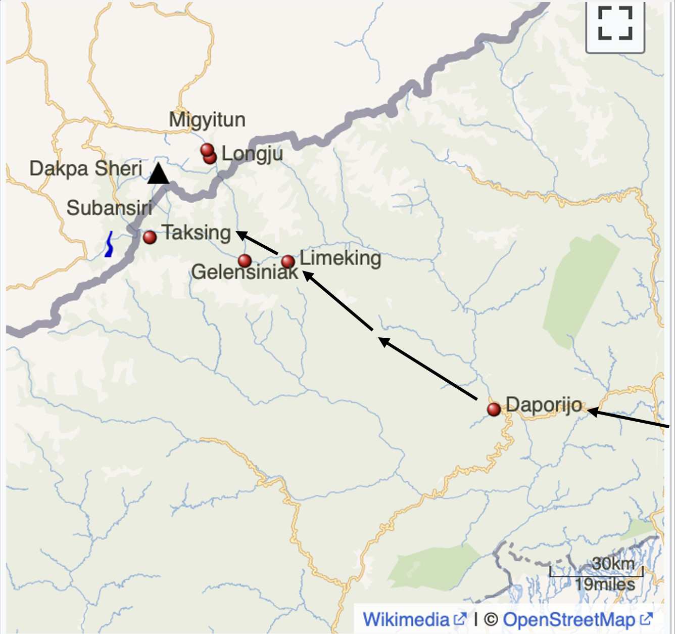
Taksing is one of the last Indian settlements in the Upper Subansiri region, close to the India-China border. Reaching it is not a simple journey. The route runs through some of the most difficult terrain in Arunachal Pradesh, passing through places such as Bara Rupak, Daporizo, Limeking, Nacho, Maja and Gelemo. The roads have improved considerably in recent years, but the terrain remains demanding and the journey can still take days.
What strikes a visitor is the combination of extraordinary natural beauty and an unmistakable security presence. The mountains, forests and rivers can make the landscape appear remote and almost untouched. Yet the presence of the Indian armed forces constantly reminds one that this is not an ordinary Himalayan settlement.
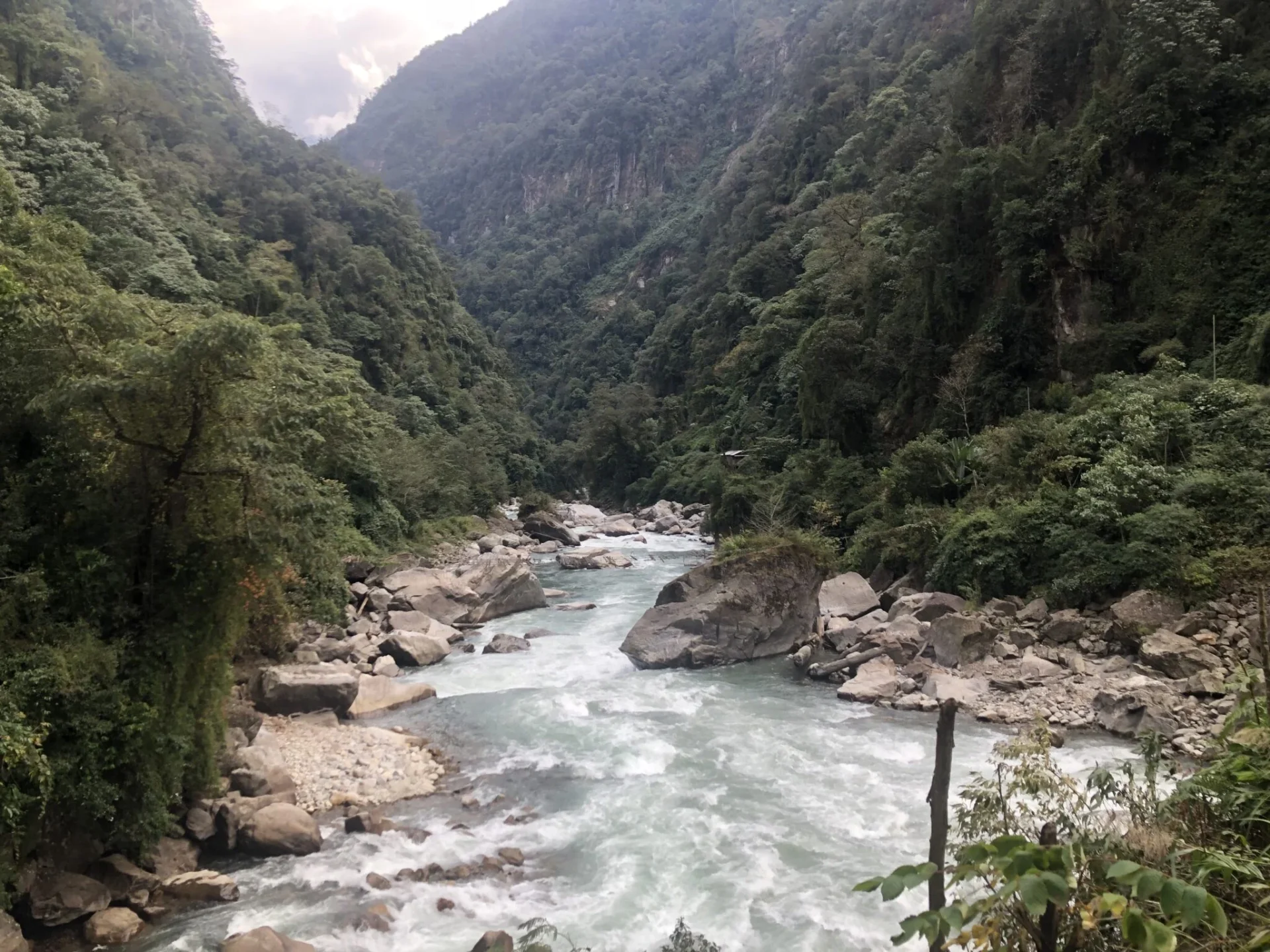
The Borderlens’ journey to Taksing and Gelemo captured this contrast particularly well. The villages lies more than 20 to kilometres from the Line of Actual Control and sits amid the mountains where the Tsari Chu meets the Subansiri. The road built along the Tsari Chu has opened up a region that was once extremely difficult to reach. The journey also passes through a landscape where military presence and civilian life exist side by side.
Villages like Taksing and Gelemo itself is home to the Na Tagin community and lies amid the enormous mountains of the Eastern Himalayas. These hamlets had long remained relatively isolated, with poor roads and difficult terrain cutting it off from the outside world. The Borderlens’ earlier field report from the area documented how the presence of the Indian Army was an everyday reality for communities living in this strategically sensitive frontier.
That isolation has begun to change. Roads have been improved under the government’s push to develop frontier villages, including through the Vibrant Villages initiative. The road towards Taksing and Maja and the border has become considerably more accessible, although reaching these settlements remains an arduous undertaking.
The strategic importance of the area is also reflected in more recent government action. In May 2026, the Arunachal Pradesh government issued a preliminary notification for the acquisition of 51.683 hectares at Tame Chung Chung, Bidak, Gelemo and Taksing for establishing elements of Indian Army brigade headquarters and infantry battalions.
Taksing and the recent incursion claims
The strategic importance of the Taksing sector has also come under renewed attention in recent months.
In June, the Nah Welfare Association (NWA) submitted a representation to the Upper Subansiri district administration alleging that Chinese People’s Liberation Army troops had expanded their presence in several strategically important areas around Taksing. The areas named included Oying in the Asaphila region, Paniar, Marpan, Portrang and Tingdingtang. The organisation also alleged that military infrastructure had been established in some of these locations.
The allegations were serious, but they were not independently confirmed. According to local media reports Tthe Indian Army subsequently rejected the claims, stating that they were not supported by facts and that there was no evidence of any fresh Chinese intrusion. Chief Minister Pema Khandu also went on record saying that there had been no Chinese incursion. He said he had spoken with members of the Nah community as well as the NWA and was confident that no such incident had taken place.
The NWA nevertheless continued to raise concerns about developments along this sensitive stretch of the frontier. The claims therefore remain contested, with the allegations of the local organisation on one side and the government’s and Army’s rejection of any fresh incursion on the other.
Whatever the truth of the specific allegations, the fact that such concerns emerge from a community living in this extraordinarily sensitive sector tells us something about the frontier itself.
What the episode does underline, however, is the extraordinary sensitivity of the Taksing sector and the importance of the communities living along this remote frontier.
Travelling through this region makes that strategic sensitivity immediately apparent.
Where the Tsari Chu connects history and geography
There is another reason this landscape matters.
The Tsari Chu is not merely a river running through a remote borderland. It is part of a much older geographical and cultural connection between Tibet and the communities of the Upper Subansiri region.
The river flows down from Tibet, enters the Indian frontier region and eventually joins the Subansiri. At Gelemo, this confluence becomes particularly striking: two river systems come together amid the enormous mountains of the Eastern Himalayas.
For centuries, the Tsari Chu valley was also part of the route of the Tibetan Tsari pilgrimage around Dakpa Sheri, or the “Pure Crystal Mountain”. The twelve-yearly pilgrimage crossed into what is now Arunachal Pradesh, travelled southwards along the Tsari Chu and then continued towards the Subansiri valley before returning towards Tibet.
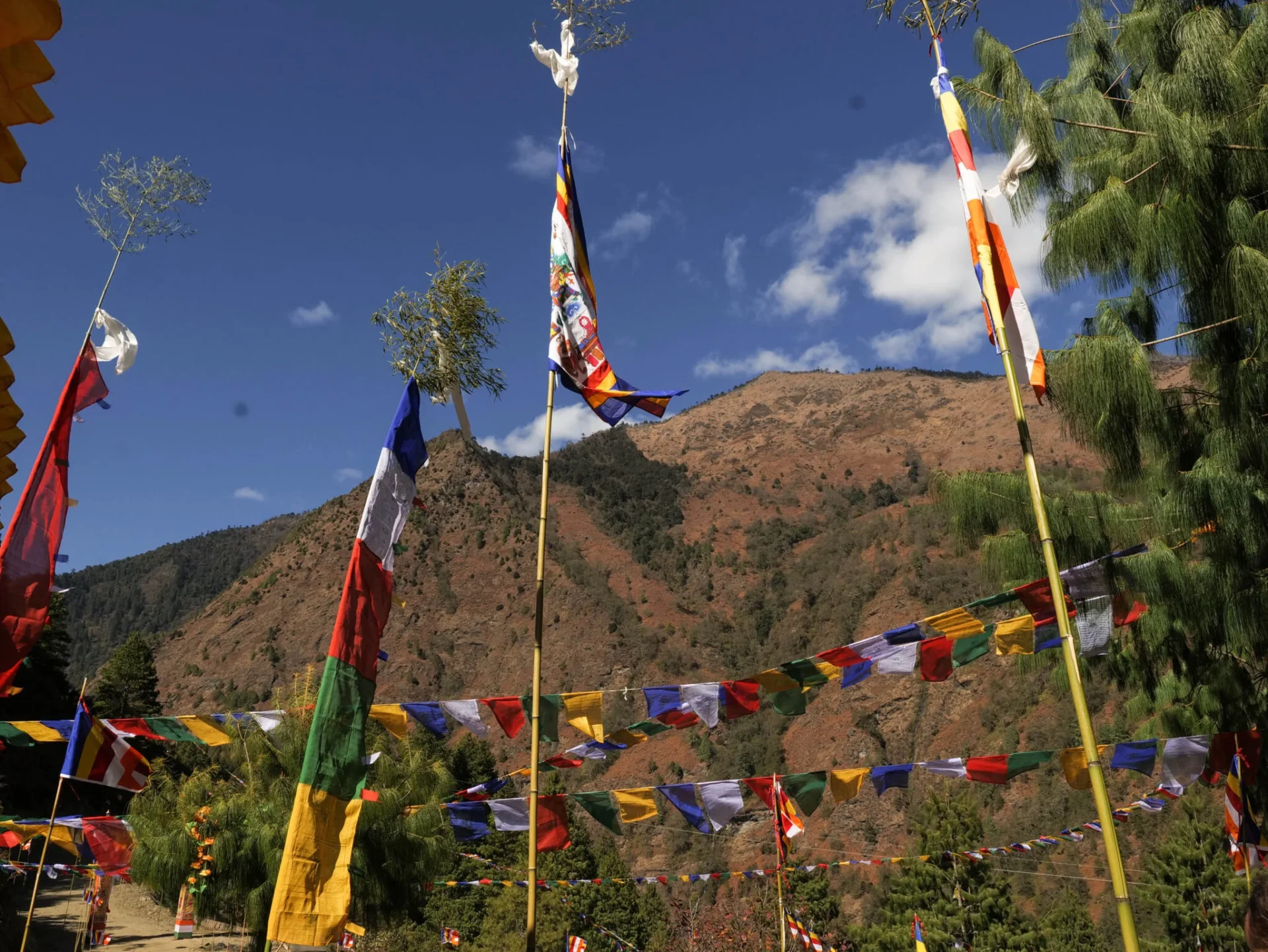
Taksing and the surrounding Tagin areas were therefore part of an old trans-Himalayan cultural landscape long before the modern border became a heavily guarded political frontier.
The last major twelve-yearly pilgrimage took place in 1956. It did not resume after tensions between India and China transformed the region. What was once a route of pilgrimage and movement gradually became a frontier defined by military posts, restrictions and strategic calculations.
That history makes the present-day politics of naming even more interesting. A name on a map may look static, but the landscape beneath it has never been static. Rivers, pilgrimage routes, settlements and communities have connected these mountains across what is today an international boundary.
Longju, Maja and the memory of 1962
The strategic importance of this landscape is not new. It is embedded deeply in the history of the India-China frontier.
Longju, one of the places included in India’s latest list, is particularly significant. The Longju incident of August 1959 was among the early violent confrontations along the disputed frontier. Indian forces subsequently withdrew from the Longju post towards Maja. The region again became a theatre of conflict during the 1962 war.
The history remains visible along the road.
Near Gelemo stands the Sher-e-Thapa Memorial, associated with Havildar Shere Thapa of 2 JAK Rifles, who fought during the 1962 war. The Borderlens’ journey through the region found the memorial standing as a reminder of the military history embedded in what otherwise appears to be an extraordinarily tranquil landscape.
The inclusion of the Sher-e-Thapa Memorial itself in the latest list of 27 places is therefore significant. India is not merely assigning names to geographical features; it is also placing the memory of its military history onto the official cartographic record.
The border is more than a line on a map
There is, however, a danger in reducing the latest exercise to a simple India-versus-China contest over names.
The real frontier is inhabited.
It is made up of villages such as Taksing and Gelemo, of Tagin communities, of roads that take days to travel, of rivers such as the Tsari Chu and Subansiri, and of soldiers stationed in some of the most difficult terrain in the country.
For the people living here, the border is not an abstract line that appears on a map. It determines connectivity, access, livelihoods, security and the extent to which the rest of India can reach them.
That is why infrastructure matters as much as cartography. The improved road to Gelemo, the continuing push to connect Maja and Taksing, and the broader development of frontier villages are not merely development projects. They are also part of how India seeks to maintain a civilian presence in a region where geography itself is a strategic challenge.
The May 2026 land acquisition notification for Army infrastructure at Tame Chung Chung, Bidak, Gelemo and Taksing adds another dimension to this continuing strategic presence.
India’s answer to China’s map politics
China may not be impressed by India’s latest cartographic move. It may even respond with another list of its own.
But that is almost beside the point.
Maps have always been political documents, particularly in contested borderlands. When China repeatedly assigns its own names to places in Arunachal Pradesh, it is not simply changing labels. It is attempting to reinforce a particular territorial narrative. India’s decision to formally standardise these 27 names is a response in the same language.
Yet the most effective answer to a cartographic challenge cannot be cartography alone.
It has to be visible on the ground.
It means roads that reach the last villages. It means communities that remain economically viable and connected. It means ensuring that people living in Taksing, Maja, Gelemo and other frontier settlements are not treated merely as occupants of a strategic landscape but as citizens whose presence is itself central to the border.
Travelling through this region makes one thing clear: the frontier is not an empty space waiting to be claimed on a map. It is already inhabited, lived in and layered with history.
The names matter. But what matters even more is the life that exists beneath those names.
And perhaps that is the strongest message India can send—not merely by naming its border places, but by ensuring that the people, roads, rivers and communities that give those places meaning remain firmly connected to the rest of the country.